Writing by NEFF Stewardship Associate Beth Gula.
Use the right tool for the job.
This is one of the “golden rules of tools” I used to preach to trail volunteers, and I always thought it was a simple, universal truth that applied to life beyond shovels and pick mattocks. Tools are designed for a particular function. Used as intended, they make a job easier and more efficient. Used improperly, they can cause anything from immense frustration to injury (or worse, as I would often say: you might break the tool!).
In the land stewardship world, technology has expanded our metaphorical toolbox immensely in recent years, with new options for how to get work done. I don’t consider myself especially technologically inclined, so based on experience, I appreciate the value of a well-designed tech tool and knowing how to use it. Here’s an introduction to a couple apps, with free versions available online, that are about as user-friendly and useful for personal adventures as they are when I’m on the clock.
Avenza + Cal Topo
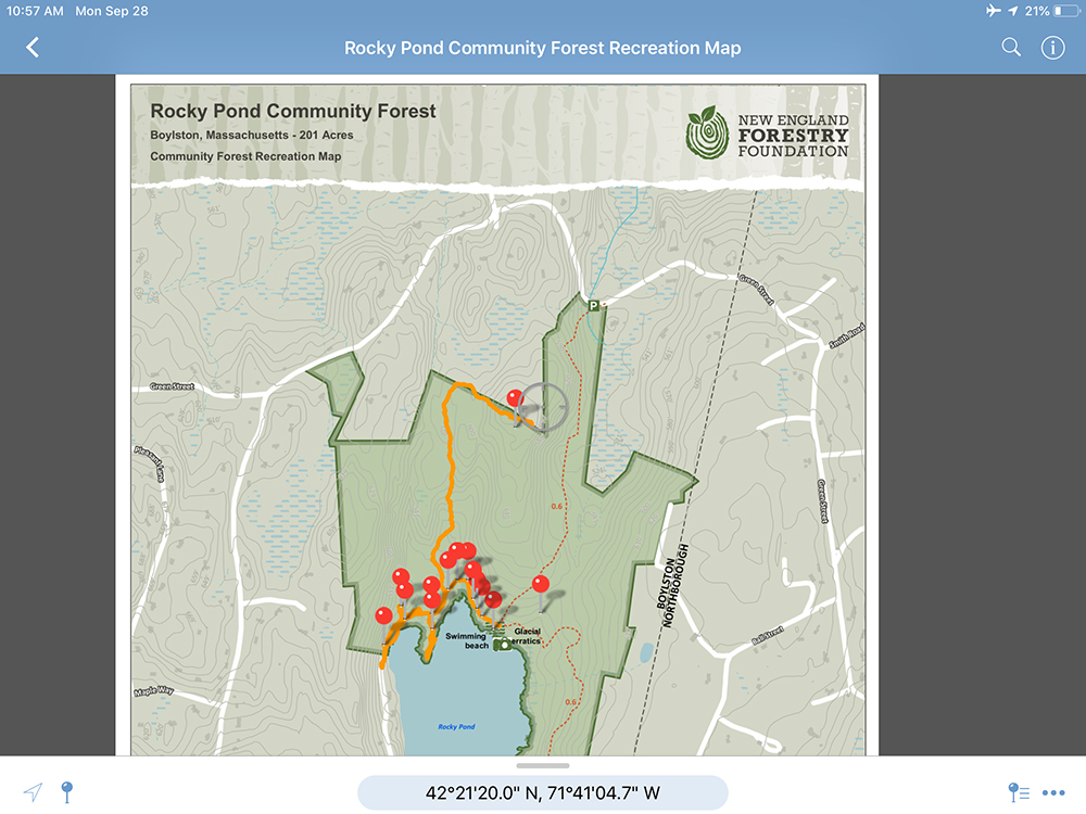
Avenza is a program we’ve relied on for monitoring NEFF conservation easements (CE) over the last few years. Before heading out into the field, I upload a “georeferenced” PDF map into the app. Once I reach my location, I open the map and my location shows up as a blue dot using the built-in GPS in my phone or tablet—no cell signal required. As I walk the CE property, the blue dot moves too, allowing me to reference my location from a bird’s eye view. Avenza lets you record a track or mark pins at waypoints that you can add photographs to or label with notes.

NEFF’s Rocky Pond Community Forest on the Avenza app using an iPad
At NEFF, we create custom georeferenced PDFs for our properties in a specialized mapping software (ArcGIS). All of the “Featured Forest” maps posted on NEFF’s website include this feature, so you can download NEFF maps for navigation in an app like Avenza, too. We’re working to roll out updated maps for all the other Community Forests, so keep checking in.

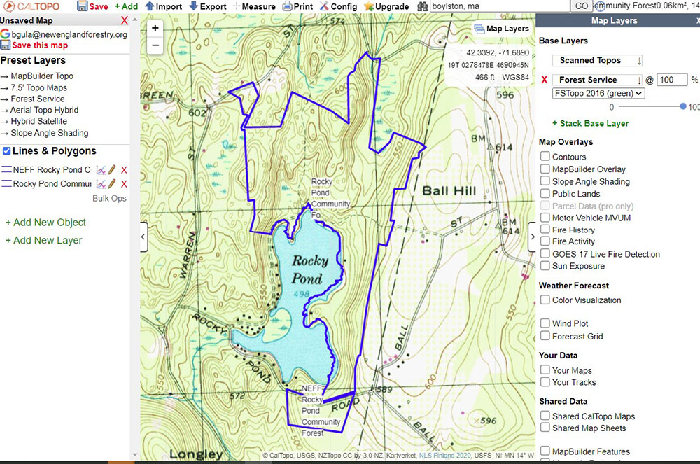
Rocky Pond Community Forest on CalTopo
If you want to explore other areas with Avenza, CalTopo allows you to create a georeferenced map of almost anywhere. Play around with the various basemaps and layouts, but a map that shows topo lines, roads, and water features is typically useful for exploration. Then print the map as a “geospatial PDF,” download to your device, and upload to Avenza. As a general disclaimer, be sure to “plan ahead and prepare” before leaving home to ensure that you’re visiting land with public access and you’re familiar with local rules and regulations.
Seek by iNaturalist
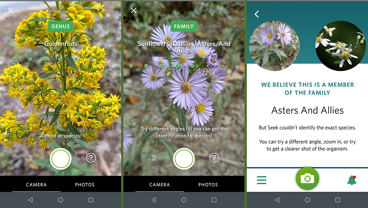
I just started experimenting with the Seek app, which uses image recognition to automatically identify any plant, animal, or fungus you encounter. After seeing fellow hikers pull out their phones to “Seek” various plants during a recent backpacking trip, and then watching a partner CE land manager use the app to confirm our suspicion of an invasive plant, I realized I had to try out this out for myself. Like Avenza, the app functions with internet access or cell data. While a definitive species ID depends on the specimen and image quality, this app is almost like magic if you want to quickly get to know the living world around you a little bit better.

Goldenrod and asters, familiar flowers this time of year
Read More
Notes From The Field: Rocky Pond Community Forest | April 17, 2020
Notes From The Field: Early Signs Of Spring | April 28, 2020
Notes From the Field: What’s Making Me Happy | May 8, 2020
Notes From the Field: Resources for Wildlife on the Go | May 26, 2020
Notes From the Field: Problem Plants’ Spring Awakening | June 5, 2020
Notes From the Field: Race and the Outdoors, Through the Lens of Birding | July 10, 2020
Notes From the Field: Wildlife Signs and More While on Walkabout | August 6, 2020
Notes From the Field: Thinking Through Conservation’s Untold Origins While Driving to Conservation Sites | August 27, 2020
Notes From the Field: A Rare Turtle Sighting | September 25, 2020
