Writing by NEFF Stewardship Associate Beth Gula.
One recent evening, as I neared the end of an after-work cross-country ski loop through my local woods, I paused at the edge of a snow-blanketed field and looked up, mesmerized. The last light of dusk had faded away and piercingly bright stars were spread across the sky. A low layer of intermittent clouds raced close above the field, making it appear by optical illusion as if Orion himself was actually gliding forward. One small, twinkling dot near his famous belt caught my attention, moving in an errant direction. Not a star, not a plane—a satellite, I realized. Satellites like this are not an unusual sight, but this time I was surprised to feel a personal connection. “I wonder if that one is going to take a picture of a NEFF forest!” I thought.

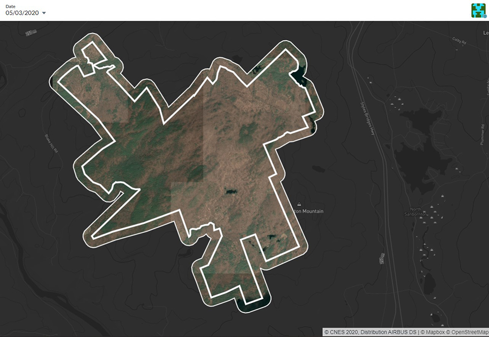
A two-dimensional satellite image of NEFF’s Hersey Mountain Forest
In recent weeks, I’ve been spending hours at my computer screen scrutinizing aerial images of NEFF forests captured by commercial satellites. In order to ensure that each of our Community Forests are monitored annually, we undertook a new program in 2020 to remotely inspect properties where we might not have a chance to get “boots on the ground” each year.
Annual property monitoring allows NEFF to observe the current condition of the land and identify any changes or potential issues. With properties spread across five states, many of which are large and in remote areas, satellite imagery is a tool that allows NEFF to remain vigilant while working from home. With the added challenges travel and field-based work have presented since the start of the COVID-19 pandemic, remote monitoring has become a much more frequent topic of discussion in my field and seems to be increasingly adopted as a standard practice for meeting land trust stewardship goals.
NEFF uses a service provider called Upstream Tech, one of a number of remote monitoring technology vendors, to source images captured by various satellite companies. To remotely review a property, NEFF stewardship staff members preview available images from throughout the year and select the best option based primarily on season—ideally early spring or late fall when there is no snow cover and no leaves on trees—and spatial resolution, meaning how clear details are when zoomed in close. We also make sure there are no clouds obscuring the satellite’s view!
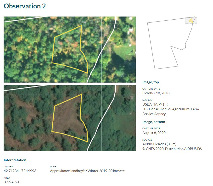
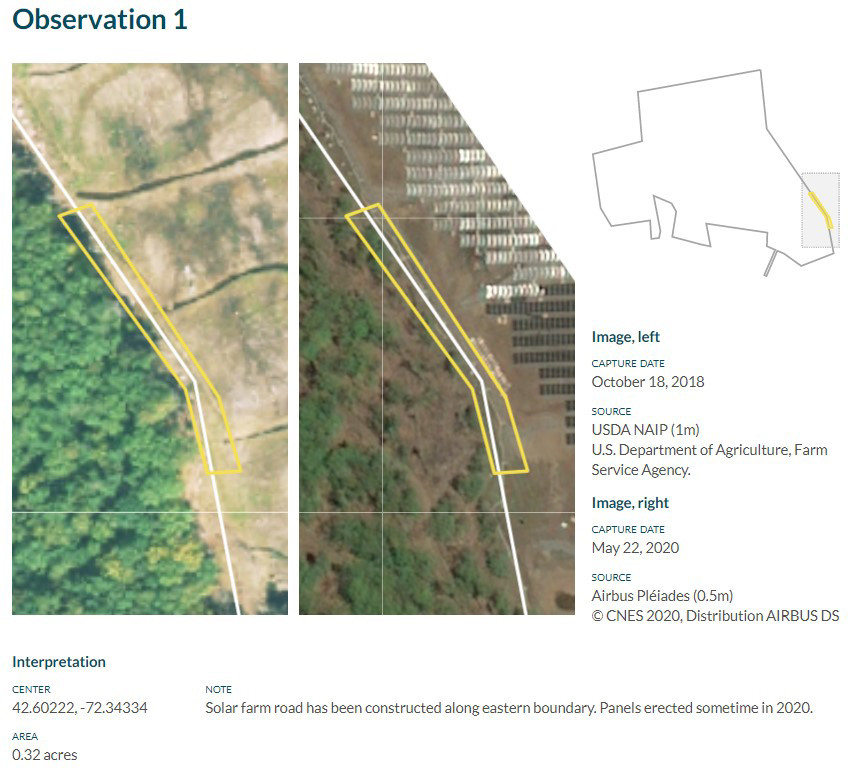
When reviewing a property image, we document notable observations, which might include expected changes like timber harvests.

Satellite imagery of before and after a harvest
We’re particularly on the lookout for unexpected changes that warrant follow-up review or action, such as a potential timber trespass or boundary encroachment. We’ll compare the current year’s image with available imagery from earlier years to understand if we’re looking at a recent change.

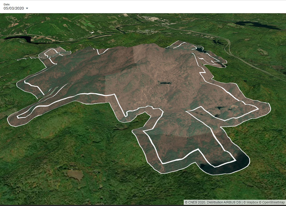
While getting physically out into the forest remains essential, remote imagery offers the opportunity to gain a new perspective on the land. Steep or remote terrain might prevent us from ever stepping foot on some areas of some properties. Satellite images literally allow us to experience the landscape from a birds-eye view and can inform where we dedicate time and effort for our next on-the-ground visit.

A three-dimensional satellite image of NEFF’s Hersey Mountain Forest
Read More
Notes From The Field: Rocky Pond Community Forest | April 17, 2020
Notes From The Field: Early Signs Of Spring | April 28, 2020
Notes From the Field: What’s Making Me Happy | May 8, 2020
Notes From the Field: Resources for Wildlife on the Go | May 26, 2020
Notes From the Field: Problem Plants’ Spring Awakening | June 5, 2020
Notes From the Field: Race and the Outdoors, Through the Lens of Birding | July 10, 2020
Notes From the Field: Wildlife Signs and More While on Walkabout | August 6, 2020
Notes From the Field: Thinking Through Conservation’s Untold Origins While Driving to Conservation Sites | August 27, 2020
Notes From the Field: A Rare Turtle Sighting | September 25, 2020
Notes From the Field: Digital Field Tools for Work and Home | October 10, 2020
Notes From the Field: Winter Woodpeckers | November 19, 2020
